Subject: Russia & Poland
Period: 1827 (dated)
Publication: Atlas Universel de Geographie Physique, Politique, Ancienne & Moderne
Color: Hand Color
Size:
14.9 x 20.1 inches
37.8 x 51.1 cm
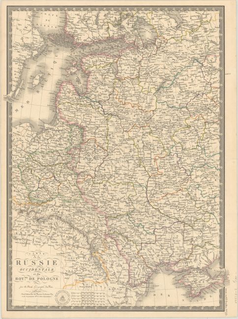
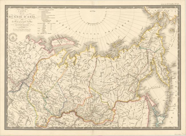
These maps of the Russian Empire are beautifully and finely engraved with great detail. Both are surrounded by a decorative keyboard-style board, embellished with fancy title lettering and flourishes, and include Brue's blind stamped imprint.
A. Carte de la Russie Occidentale et du Royme. de Pologne, dated 1827 (14.9 x 20.1"). This map focuses on the heart of European Russia and includes tremendous detail. It shows all of Poland and extends east to the Black Sea to show all of the Crimea, and north to above St. Petersburg.
B. Carte de la Russie d'Asie, dated 1830 (20.0 x 14.3"). This map shows Russia in Asia from the Ural Mountains to Bering Strait. It includes the northern islands of Japan, the Kuril Islands and Kamchatka.
References:
Condition: A
On sturdy sheets with contemporary outline color and a few negligible spots. There are small remnants of hinge tape on the verso of the western map.