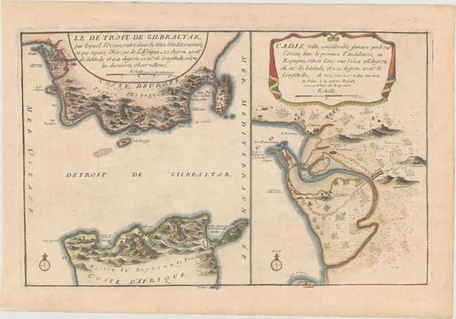
Subject: Strait of Gibraltar & Cadiz, Spain
Period: 1705 (dated)
Publication: Les Forces de l'Europe
Color: Hand Color
Size:
12.9 x 8.2 inches
32.8 x 20.8 cm
Nicolas de Fer held the title of geographer at Louis XIV's court. He was one of the most prolific publishers of plans of European cities in the late seventeenth century. The fortifications plans in Les Forces de l'Europe were designed to teach fortification techniques. Engraved by Van Loon and Schoonebeek after French engineers under the command of Vauban, the renowned military architect. The illustrations often include a description and a legend with the principal buildings; each city plan includes both fortifications and street layout.
This sheet includes a map of the Strait of Gibraltar with a focus on the fortifications in Spain and northern Africa, as well as a map of the port city of Cadiz and its surroundings. This is the second state, with the date updated to 1705.
References: Pastoureau, FER IX C.
Condition: B+
A nice impression on paper with a bunch of grapes watermark and light toning.