Subject: Northern France
Period: 1680 (circa)
Publication:
Color: Hand Color
Size:
20.4 x 15 inches
51.8 x 38.1 cm
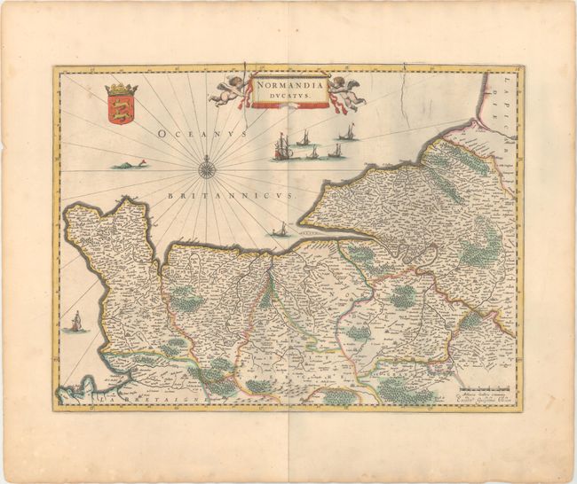
This very detailed map of the Normandy coast extends from Cherbourg and Avranches in the west to Dieppe and Rouen in the east. The map also features Caen, Le Havre, and Mont Saint Michel in the lower left corner. A compass rose, ships, fishing boats, and a sea monster are depicted in the English Channel. The map is adorned with a large title cartouche flanked by putti and Normandy's coat of arms. This example has a blank verso and is not specifically listed in Van der Krogt. There are cracks in the plate, indicating that it is a late printing. Published in a composite atlas with maps from De Wit, Jansson, Visscher, and others.
References: Van der Krogt (Vol. II) #4400:2.
Condition: B+
A crisp impression with light scattered foxing and a small abrasion in the title cartouche. There is a centerfold separation entering 4.75" into the neatline at bottom that has been closed on verso with archival materials.