Subject: France
Period: 1741 (published)
Publication: Description Exacte de l'Univers, ou l'Ancienne Geographie Sacree et Profane
Color: Hand Color
Size:
19 x 15.3 inches
48.3 x 38.9 cm
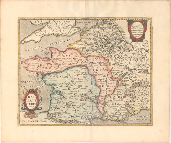
This is a re-engraved edition of Abraham Ortelius' map of the same title. This lovely map of France during Roman times was based on ancient geographical sources including Strabo, Plinius, Virgilius, Ovidius and Caesar. The map is filled with detail and ancient place names. Adorned with stipple engraved oceans and two fine cartouches, which were updated from Ortelius' map and help distinguish the two editions. Blank verso, published in Pieter de Hondt's Description Exacte de l'Univers, ou l'Ancienne Geographie Sacree et Profane, a French edition of Georgius Hornius' Accuratissima Orbis Antiqui Delineatio, which included maps from Johannes Jansson's historical atlas and Abraham Ortelius' Parergon.
References: Van der Krogt (Vol. I) #4000H:1B2.
Condition: A
A sharp impression on a clean, bright sheet with a couple of creases in the top right corner.