Catalog Archive
Auction 171, Lot 478

"Comitatus Zelandiae Tabula", Wit, Frederick de

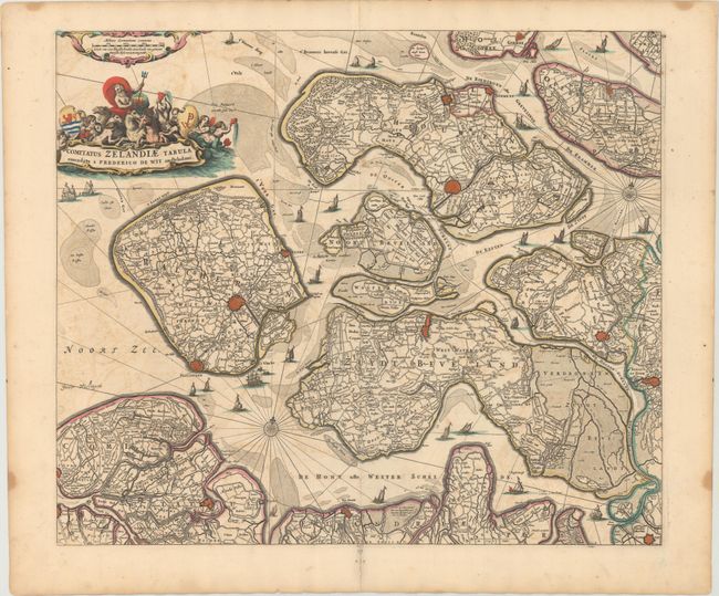
Subject: Southwestern Netherlands

Period: 1680 (circa)

Publication:

Color: Hand Color

Size:
21.3 x 18 inches
54.1 x 45.7 cm
Download High Resolution Image
(or just click on image to launch the Zoom viewer)

This handsome map of Zeeland details the islands of Walcheren, Beveland, Schouwen, and Tholen within the Schelde estuary, and Flanders in the south. The map illustrates the topography, roads, towns, and fortified cities, including Middelburgh, Tolen, and Berg op Zoom. Neptune sits astride the aquatic-themed cartouche at top left, and sailing ships navigate among the islands.

References:

Condition: B+

A fine impression with light offsetting and scattered foxing.

Estimate: $450 - $550

Unsold

Closed on 2/6/2019

Archived