Catalog Archive
Auction 171, Lot 467

"Nouvelle Carte de Scandinavie ou des Etats du Nord Dressee sur les Observations les Plus Nouvelles...", Chatelain, Henry Abraham

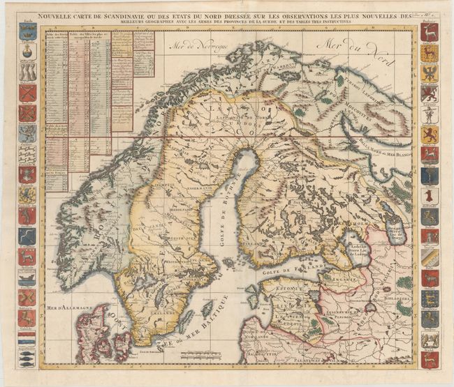
Subject: Scandinavia

Period: 1720 (circa)

Publication: Atlas Historique

Color: Hand Color

Size:
23.4 x 19.6 inches
59.4 x 49.8 cm
Download High Resolution Image
(or just click on image to launch the Zoom viewer)

This map of Scandinavia shows all of Finland, Sweden, Norway, and Denmark, and includes most of the Baltic states. Extends into Russia to show most of the White Sea and the area around Moscow. Precisely engraved to include scores of towns and villages, watershed and coastal details. Tables at top left identify provinces, towns, Archbishoprics, copper mines, and more within the map. Flanked with coats of arms of the various provinces at the sides.

References:

Condition: A+

A crisp impression on a clean, bright sheet with an elephant watermark.

Estimate: $275 - $350

Sold for: $240

Closed on 2/6/2019

Archived