Subject: Ireland
Period: 1695 (circa)
Publication: Camden's Britannia
Color: Hand Color
Size:
13.7 x 16.3 inches
34.8 x 41.4 cm
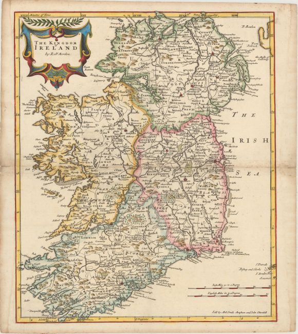
This detailed map of Ireland is divided into the four provinces of Ulster, Connaught, Leinster, and Munster. Many locations and geographical features are identified on this map, most notably roads. The map includes a decorative cartouche and two distance scales. An inscription at the bottom indicates that the map was sold by Abel Swale, Awnsham and John Churchill.
References: Shirley (BL Atlases) #T.CAMD-5a.
Condition: B+
A crisp impression with a "MC" watermark and minor foxing along the centerfold at right. There are light damp stains in margins, with the stain at left just touching the neatline.