Catalog Archive
Auction 171, Lot 461

"A Mapp of the Kingdome of Ireland", Blome, Richard
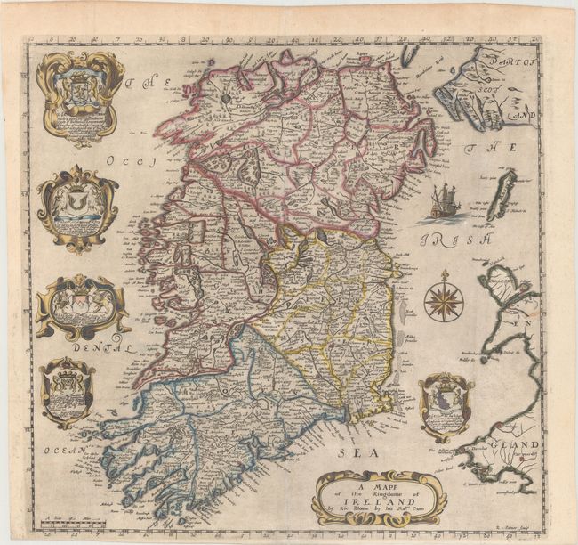
Subject: Ireland

Period: 1673 (circa)

Publication: Britannia

Color: Hand Color

Size:
15 x 14.3 inches
38.1 x 36.3 cm
Download High Resolution Image
(or just click on image to launch the Zoom viewer)

An attractive map of Ireland that was issued in Blome's Britannia: Or, A Geographical Description of the Kingdoms of England, Scotland, and Ireland. Shirley describes the maps in this work as "based on those by John Speed but reduced in size." Cartographically, the map shows the whole island and extends east to include small portions of England, Wales and Scotland. There is good interior detail of settlements, lakes, rivers, roads, and topography. The coastlines are also well-rendered with numerous offshore islands depicted. Decorated by five dedication cartouches with crests, a compass rose with fleur-de-lis, and a sailing ship in the Irish Sea. Engraved by Richard Palmer, whose signature appears in the bottom right corner of the map.

Richard Blome was one of the most interesting, and most active, publishers of illustrated books in post-Restoration London. There is an excellent biography on MapForum.com.

References: Shirley (BL Atlases) T.BLOM-2a.

Condition: B+

A dark impression on watermarked paper with a short repaired fold separation at bottom and some minor chalk residue in the upper portion of the image. Issued folding.

Estimate: $350 - $425

Sold for: $275

Closed on 2/6/2019

Archived