Catalog Archive
Auction 171, Lot 438

NO RESERVE

"Anglesey, Ins. [on sheet with] Wight ol. Vectis [and] Ins. Garnesey [and] Ins. Iarsey", Mercator/Hondius

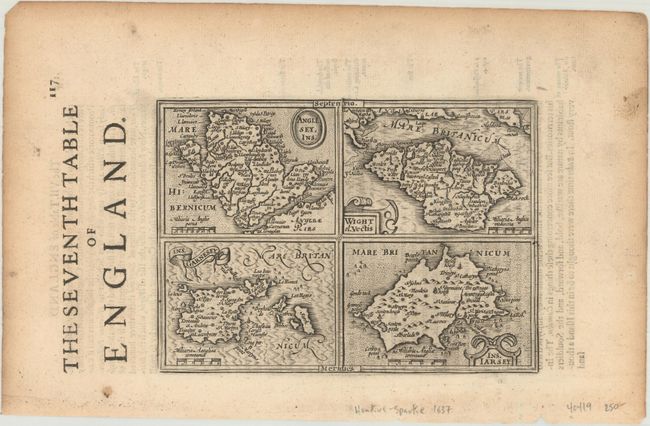
Subject: Channel Islands

Period: 1635 (circa)

Publication: Historia Mundi or Mercators Atlas...

Color: Black & White

Size:
6.8 x 4.9 inches
17.3 x 12.4 cm
Download High Resolution Image
(or just click on image to launch the Zoom viewer)

This is a reduced version of Mercator's folio map with four maps on one sheet depicting the English islands of Jersey, Guernsey, Wright and Alderney. Each map is embellished with its own decorative title cartouche and scale of miles. This example appeared in the English edition of Mercator's Atlas Minor, which was published under the title Historia Mundi or Mercators Atlas by Michael Spark and Samuel Cartwright. After acquiring the plates to the 1607 edition of the Mercator/Hondius Atlas Minor, Sparke republished the maps with text translated into English by Wye Saltonstall. English text on verso, with two sheets of related English text included with this lot.

References: Van der Krogt (Vol. III) #5700:351.

Condition: A

Marginal soiling and toning.

Estimate: $60 - $80

Sold for: $60

Closed on 2/6/2019

Archived