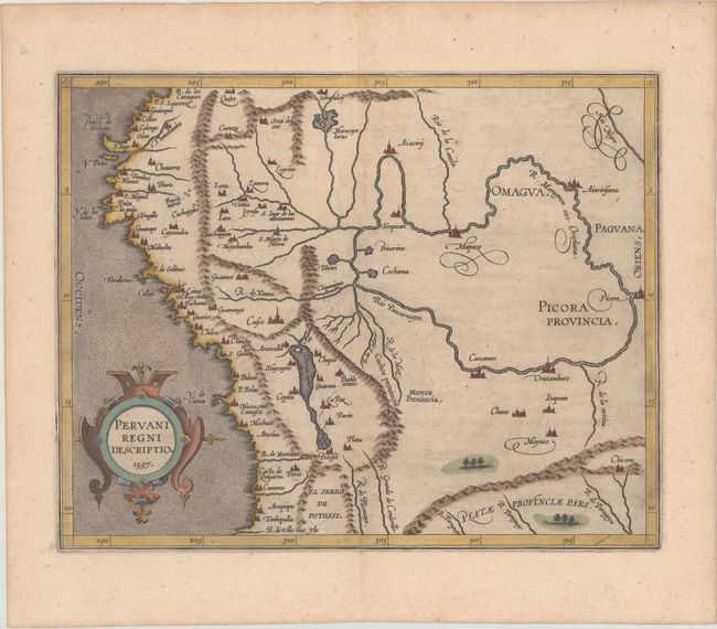
Subject: Peru
Period: 1597 (dated)
Publication: Descriptionis Ptolemaicae Augmentum…
Color: Hand Color
Size:
11.3 x 8.9 inches
28.7 x 22.6 cm
This important early map of Peru is finely engraved with numerous cities located throughout. Lake Titicaca is elongated and joined with Aulaga Lake. The map is embellished with a large strapwork title cartouche and a stipple engraved sea. This is the first state of the map with the date in the title cartouche, and appeared in Wytfliet's Descriptionis Ptolemaicae Augmentum… in 1597, which is considered the earliest atlas to focus on the Americas.
References: Mickwitz & Miekkavaara #308-6.
Condition: A
A dark impression on paper with a lion watermark, a hint of toning, and a tiny worm track near the center of the image that has been professionally infilled, with minute loss of image.