Subject: Greater Antilles
Period: 1692 (circa)
Publication: De Nieuwe Groote Lichtende Zee-Fackel...
Color: Hand Color
Size:
22.9 x 20.3 inches
58.2 x 51.6 cm
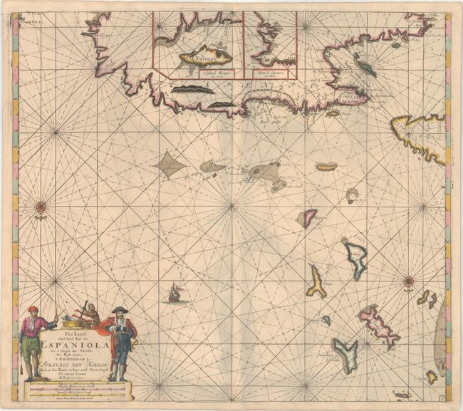
This handsome sea chart depicts the northern part of Hispaniola, the eastern end of Cuba, the adjacent Turks and Caicos Islands, and the southern Bahamas as far north as San Salvador. Presented on an unusual projection, north is oriented to the bottom of the sheet. There are two large insets providing details of Tortuga Island and Port of Guanives. The map is adorned with a compass rose, sailing ship, and a figurative cartouche flanked by two swashbuckling pirates.
References:
Condition: B+
A dark impression on heavy paper with very minor soiling and a number of small worm holes in the lower half of the image, mostly confined to the seas, that have been professionally infilled with a minor amount of the image replaced in facsimile. There is a tiny centerfold separation at bottom that just touches the neatline. There are some grayish shadows on the image that are caused by our scanner and do not appear on the map itself.