Catalog Archive
Auction 171, Lot 341

"Insulae Americanae Nempe: Cuba, Hispaniola. Jamaica. Pto Rico. Lucania. Antillae Vulgo Caribae. Barlo-Et Sotto-Vento. Etc.", Ottens, Reiner and Joshua

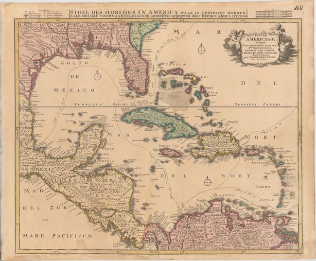
Subject: Gulf of Mexico & Caribbean

Period: 1730 (circa)

Publication:

Color: Hand Color

Size:
22.6 x 19.4 inches
57.4 x 49.3 cm
Download High Resolution Image
(or just click on image to launch the Zoom viewer)

The Ottens brothers based this map of the West Indies on Danckerts' map of the same title. He updated the Gulf Coast and Mississippi River delta based on the important map of Delisle, but the Florida peninsula is filled with spurious mountains. The routes of the Spanish treasure galleons are carefully plotted and there is excellent coastal detail. Two putti support the cartouche in the upper right corner. The Dutch title, "Stoel des Oorlogs in America waar in vertoont werden alle desself voornaamste Eylande nieuwelycks uytgegeven," with a mileage scale and key, appear in the top margin.

References: cf. Manasek #64.

Condition: B+

A nice impression with contemporary color on a sturdy sheet with light toning and some damp stains at bottom, entering the image just below the word "Pacificum."

Estimate: $900 - $1,100

Unsold

Closed on 2/6/2019

Archived