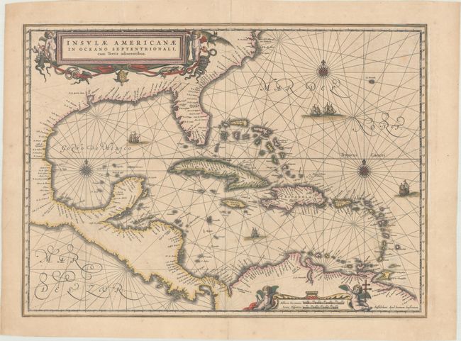
Subject: Gulf of Mexico & Caribbean
Period: 1646 (circa)
Publication: Atlas Novus
Color: Hand Color
Size:
20.5 x 14.9 inches
52.1 x 37.8 cm
This handsome map focuses on the West Indies and covers the region from the Chesapeake through the Gulf of Mexico, with Central America and the northern part of South America. Details are confined to the coastlines. Cartographically it is based on the extremely rare chart of Hessel Gerritsz from 1631 and is nearly identical to Blaeu's map of the same title. This is the first state of this map, with Latin text on verso, published between 1646-57. Lovely title and scale of miles cartouches, rhumb lines, compass roses, and sailing ships make this a very attractive map.
References: Burden #248; Van der Krogt (Vol. I) #9600.1.
Condition: B+
Contemporary color with minor toning and foxing, light soiling, and archival repairs to centerfold separations that just enter the map border at top and bottom, a tear that enters 1/2" into image at bottom left, and several minor marginal tears. The green pigmented areas have been archivally reinforced on verso repairing two short cracks, and the paper is otherwise quite supple.