Catalog Archive
Auction 171, Lot 290

"Colton's New Map of the State of Texas Compiled from De Cordova's Large Map", Johnson & Browning
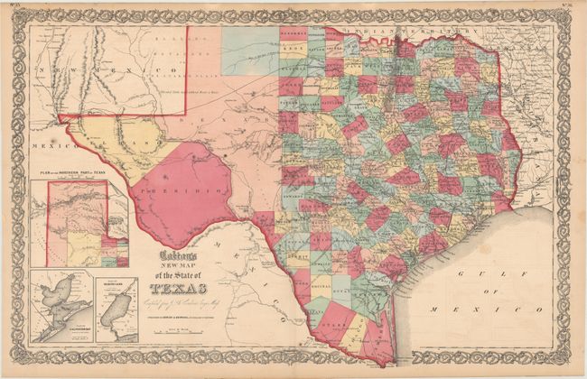
Subject: Texas

Period: 1855 (dated)

Publication: Illustrated Family Atlas

Color: Hand Color

Size:
26 x 16.6 inches
66 x 42.2 cm
Download High Resolution Image
(or just click on image to launch the Zoom viewer)

This double-page map shows extensive detail throughout the settled part of the state. The western third is comprised of the large unsettled areas of Presidio, El Paso, Bexar and the Staked Plain. Locates railroads, forts, post offices, roads, springs, and topographical detail. Includes three inset maps: Plan of the Northern Part of Texas, Plan of Galveston Bay from the U.S. Coast Survey, and Plan of Sabine Lake. Surrounded by Colton's decorative scroll borders. Dated 1855 but published in 1859.

References:

Condition: B+

Original color with light offsetting, minor toning, and a few spots of foxing.

Estimate: $375 - $450

Sold for: $200

Closed on 2/6/2019

Archived