Subject: World
Period: 1729 (published)
Publication:
Color: Hand Color
Size:
18.1 x 13.9 inches
46 x 35.3 cm
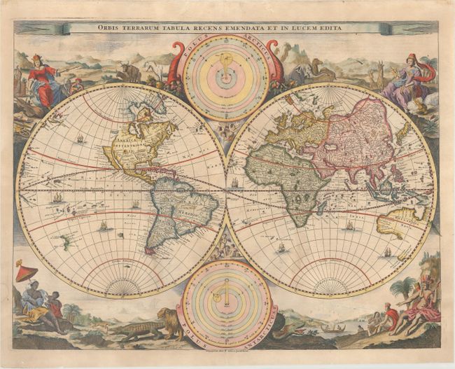
This decorative double hemisphere world map was issued in a Dutch Bible published by the Keur family. It is based on Visscher's Bible map of 1663 and is surrounded by nearly identical engravings, which include numerous exotic animals and four female allegorical representations of the continents. California is depicted as an island with a flat northern coastline labeled Nova Albion. A small island in the vicinity of Alaska is labeled Anian. In Asia, the Great Wall of China is illustrated and the northeastern coastline is severely truncated. Australia, Van Diemens Landt, and New Zealand have incomplete coastlines. New Guinea looks as if it may be attached to Australia. Tucked between the cusps of the map are astronomical diagrams illustrating the Copernican and Ptolemaic solar system theories. This is the third state published by Pieter and Jacob Keur. Dutch text on verso.
References: Shirley #498; Poortman & Augusteijn #130 GII<sup>3</sup>.
Condition: B+
Minor soiling with a small damp stain in the left blank margin. There are professional and nearly invisible repairs to a long centerfold separation at bottom, a few small worm holes, and matching horizontal tears that enter 6" into the decorative vignettes at bottom on both sides of the sheet.