Subject: North Carolina, Civil War
Period: 1864 (dated)
Publication:
Color: Hand Color
Size:
27 x 39.9 inches
68.6 x 101.3 cm
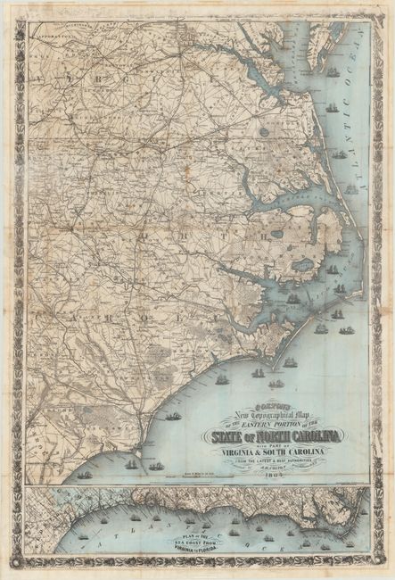
This very large Civil War period pocket map is a companion map to Colton's similar map of the Mid-Atlantic states. The map extends as far west as Raleigh and Fayetteville and north to Richmond, Virginia. With exceptional detail on a scale of 8 miles per inch, the map shows towns and villages, counties, topography, watershed, roads, and railroads. At bottom is an inset map of the eastern seaboard from North Carolina to northern Florida, oriented with north to the top right. The map is embellished with fancy titling, numerous types of ships at sea, and an elaborate floral and wheat-themed border. Printed by H.P. Cooper. Copyrighted 1860, this edition is updated to 1864. All editions of this map are very rare. Covers not included with this example.
References: Rumsey #3044.000; Stephenson (Civil War) #305.
Condition: B
Original wash color with an overall dark impression with the exception of the top border, which appears not to have been inked properly. Issued folding with light toning along several folds, some small stains, and short fold separations closed on verso with tape. There are two very short tears and some staining at far left where the map was originally pasted into covers.