Subject: Maui, Hawaii
Period: 1903 (dated)
Publication:
Color: Printed Color
Size:
53.4 x 43.5 inches
135.6 x 110.5 cm
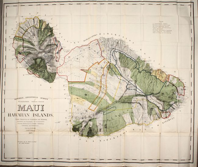
This large, handsome map depicts Maui in great detail shortly after its annexation by the United States. Maui was the main island of the "county group" with a population approaching 40,000. Survey work during the previous decade had resulted in preparation of good maps, but there remained the problem of laying out the lands for settlement under existing land laws. This map delineates those lands for sale, awarded lands, and much more. The map was made under the direction of W.D. Alexander, Surveyor General. It was drawn by F.S. Dodge in 1885, with topography by Alexander, Dodge, C.J. Lyons, M.D. Monsarrat, S.E. Bishop, E.D. Baldwin, and W.R. Lawrence. This edition has been updated to 1903 by John M. Donn.
References:
Condition: B+
A colorful example, issued folding, with a hint of toning along the lower fold and several tiny splits at fold intersections.