Subject: Delaware
Period: 1822-38 (circa)
Publication:
Color: Hand Color
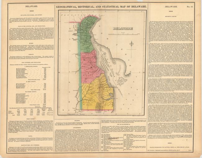
A. Geographical, Historical, and Statistical Map of Delaware, by Carey & Lea, from A Complete Historical, Chronological, and Geographical American Atlas, circa 1822 (9.5 x 11.6"). This map was drawn by Fielding Lucas and engraved by the firm of Young & Delleker. It shows the state with a population of less than 73,000 including approximately 4,500 slaves and 13,000 "Free Blacks." In Delaware Bay numerous shoals with the "Main Ship Channel" are depicted winding its way through the hazards. There is a modest network of wagon roads with towns and settlements including George Town, Louisville, Dover and Wilmington. The map is on a full folio sheet (20.4 x 16.5") surrounded by English text giving a brief description of the state’s boundaries, rivers, climate, chief towns, government and history. Condition: Light toning with a small stain and repaired short centerfold separation at bottom. (B+)
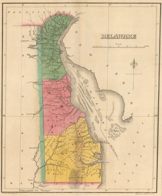
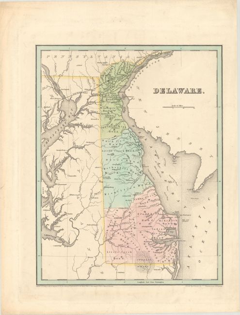
B. Delaware, by Thomas Gamaliel Bradford, dated 1838 (11.2 x 14.4"). This attractive map of the state is divided into three counties with further divisions into "hundreds" (holdover terminology from when Delaware was a British colony). Shows place names, county seats, a few railroads and canals in the northern portion of the state, and navigational information in the Delaware Bay. The map extends to include the northern Chesapeake Bay. Condition: A nice impression on a bright sheet with some minor soiling in the blank margins. (A)
References:
Condition:
See description above.