Subject: Arizona
Period: 1905 (published)
Publication:
Color: Printed Color
Size:
16.8 x 20.3 inches
42.7 x 51.6 cm
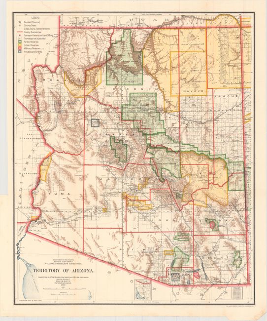
A colorful and fascinating map that provides a detailed look at the territory just seven years before statehood. The extent of nine Indian reservations and three military reservations, including Fort Apache, and numerous National Forest Reserves are clearly shown in different colors. Private claims, confirmed and unconfirmed, are outlined in red. The Grand Canyon Forest Reserve is shown. Brown hachured mountainous areas and blue waterways combine to provide great visual impact. Details include watershed, mountains, railroads, wagon roads, private claims, unsurveyed townships, etc. This map initially appears identical to the 1903 edition, but closer study shows subtle but important differences. Drawn by Daniel O'Hare, and lithographed by the Norris Peters Co., Photo-Litho. Complete with the original 86-page "Report of the Governor of Arizona," a seldom seen bonus not normally offered with the map.
References:
Condition: A
Map issued folding with minor color offsetting, a couple faint spots, and a binding trim in the left margin, as issued. Report is disbound.