Subject: Alabama
Period: 1822 (published)
Publication: A Complete Historical, Chronological, and Geographical American Atlas
Color: Hand Color
Size:
9.1 x 11.8 inches
23.1 x 30 cm
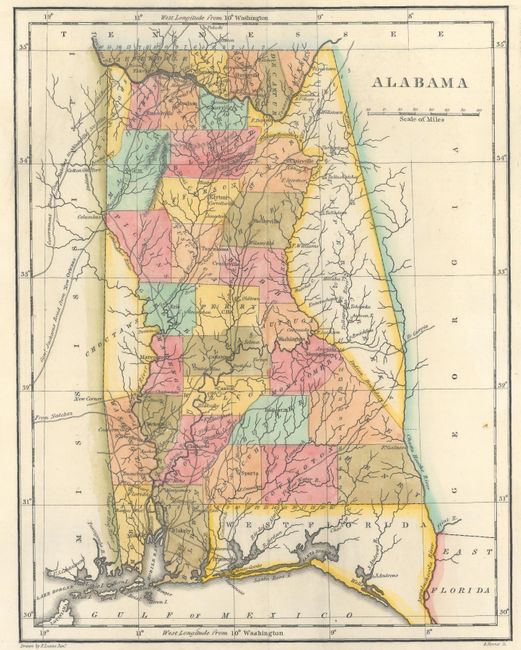
This early map of Alabama is on a full folio sheet (20.5 x 16.6") with English text below and on sides concerning the state's topography, climate, population, history, and other fascinating information. County development is up-to-date, with the new counties of Covington, Pike, and Decatur delineated. Indian lands are located, with an area in the western part of the state for the Choctaws and the unorganized area to the east split between the Cherokees and Upper Creeks. The map extends to show part of Mississippi, Georgia, and East and West Florida. Roads are shown including Government Road from Natchez to Nashville and Genl. Jacksons Road from New Orleans, referring to future president Andrew Jackson's return route from the Battle of New Orleans, the last major battle of the War of 1812. Drawn by Fielding Lucas Jr. and engraved by B. Tanner.
References: Phillips (Maps) p. 92.
Condition: A
There are several archivally repaired short edge tears, all well away from the map image.