Catalog Archive
Auction 171, Lot 204

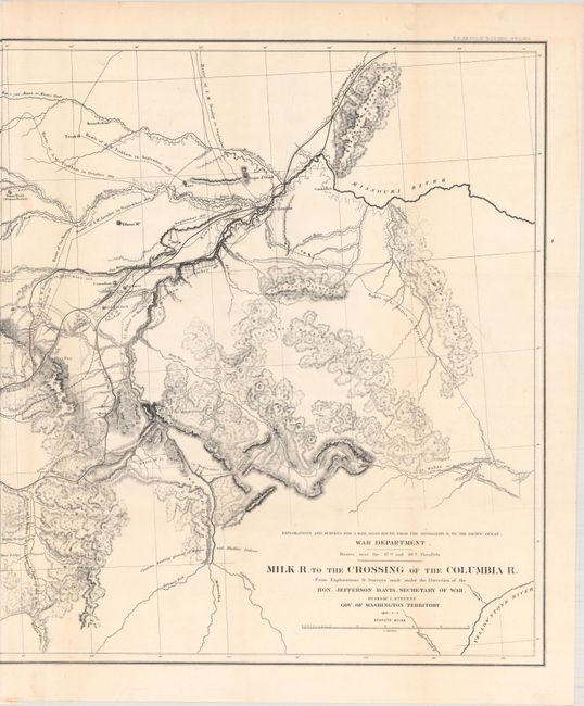
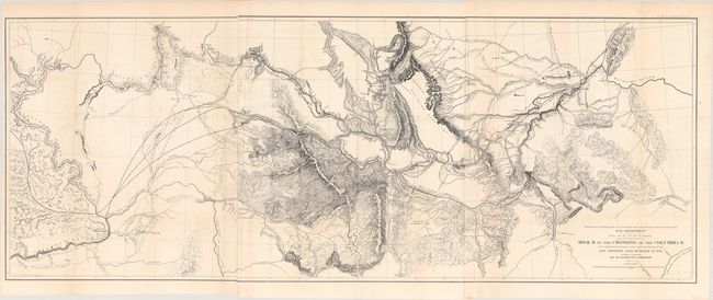
"Milk R. to the Crossing of the Columbia R. from Explorations & Surveys Made Under the Direction of Hon. Jefferson Davis, Secretary of War", U.S. Railroad Surveys

Subject: Northwestern United States

Period: 1853-55 (dated)

Publication: U.S. Pacific Railroad Surveys

Color: Black & White

Size:
60.7 x 23.4 inches
154.2 x 59.4 cm
Download High Resolution Image
(or just click on image to launch the Zoom viewer)

Remarkable map that details the 1853-55 surveys conducted to locate a northern route (47th and 49th Parallels) on an expedition led by Isaac Stevens, Governor of Washington Territory. Most of the map covers Montana, with extraordinary detail and excellent relief by hachure, the naming of rivers, numerous routes with dates, and interesting topographical commentary. The map not only shows the main party's route, but also numerous routes followed by the various parties attached to the command. Printed on three sheets, joined as issued. It is dated 1853-55, but was published in 1860.

References: Wheat (TMW) #867.

Condition: A

A crisp, dark impression with a few faint spots, otherwise fine.

Estimate: $275 - $350

Sold for: $200

Closed on 2/6/2019

Archived