Subject: Minnesota & Dakota Territory
Period: 1860 (dated)
Publication: Mitchell's New Universal Atlas
Color: Hand Color
Size:
16.3 x 13 inches
41.4 x 33 cm
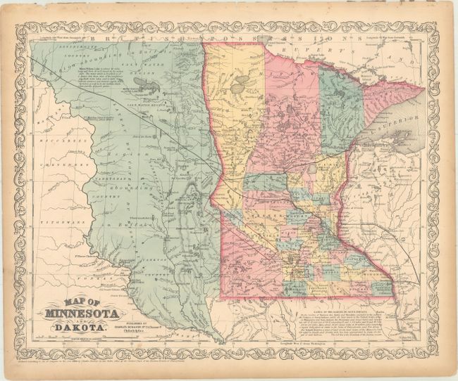
This lovely steel engraved map comes from the 1860 edition of this famous atlas. Ristow states the 1859 edition was the final edition and that it was published by Cushings & Bailey. This map, however, carries the 1860 date with Desilver's imprint, but also lists Desilver as the publisher. The map shows the newly formed Dakota Territory as a huge unorganized area with its western boundary along the Missouri River. It is filled with tribes and place names, and interesting notations, such as "Region abounding in Buffalo", and " Old Sioux Turkey Hunting Ground." Railroads, stage, and wagon roads reflect the westward development. A thin strip of land, mostly in Minnesota, is the Dakota Reserve. Notation at lower right describes the treaties and lands of the Dakota or Sioux Indians. With Desilver's unique scroll border and his imprint at No. 714 Chestnut St., Philadelphia.
References: Ristow pp. 313.
Condition: B+
There are a few faint spots in the image and light toning along the sheet edges.