Subject: North Central United States
Period: 1878 (circa)
Publication:
Color: Black & White
Size:
21.3 x 15.3 inches
54.1 x 38.9 cm
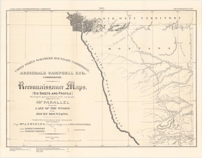
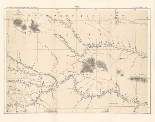
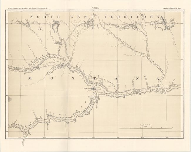
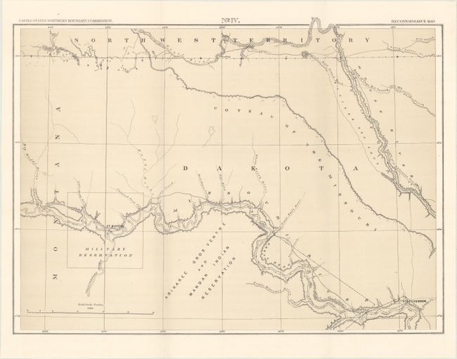
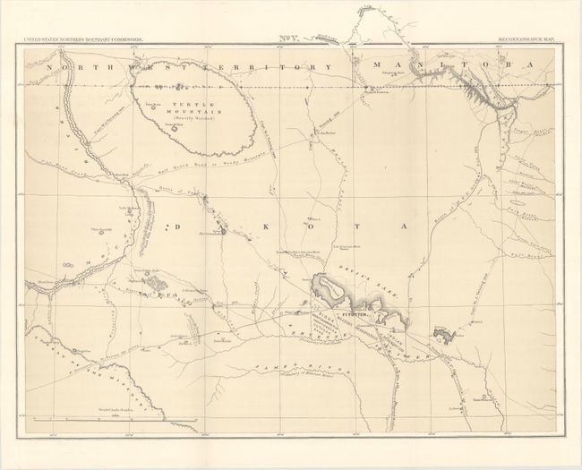
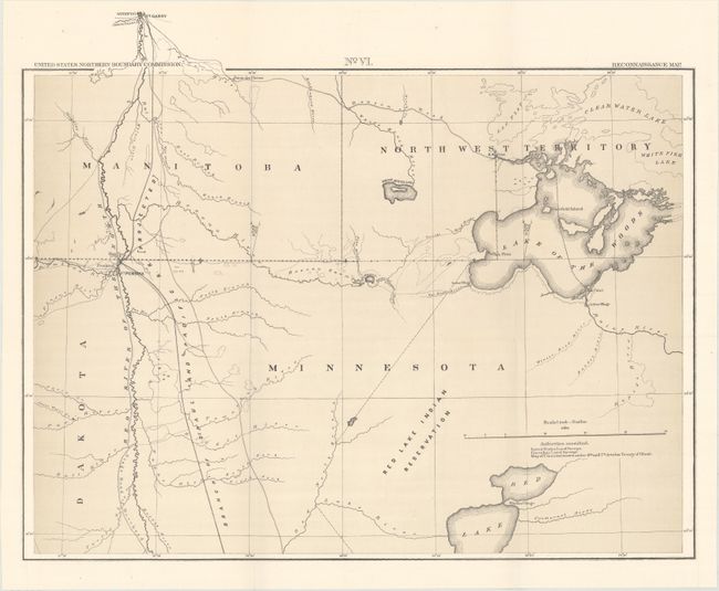
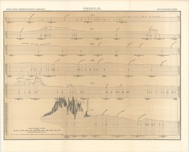
A complete and matching set of six maps and profile sheet on the Northern Boundary Survey. In 1872, Congress authorized a survey to determine and mark the U.S. - Canadian Boundary line along the 49th parallel. The survey accurately determined the boundary, and added very detailed topographical features in a 5-mile wide strip along the line. The survey was completed in 1875 and published by Archibald Campbell and William Twining in 1878. These maps cover the area from the Rocky Mountains in Montana to the Lake of the Woods in Minnesota and 100 miles north to south. They provide excellent detail of rivers, towns and forts, springs, and topographical data. Locates the Blackfoot Indian Agency, Ft. Shaw, Ft. Benton, River Crow Indian Agency, Ft. Belknap, Old Fr. Browning, Ft. Turnay, Ft. Peck, Ft. Hawley, Ft. Buford, Ft. Berthold, Ft. Stevenson, Ft. Totten, Ft. Pembina, and Ft. Garry (Canada), plus numerous trading posts, Indian villages, and much more. A historically important set of maps.
References: Wheat (TMW) #1289.
Condition: A+
Fine. Issued folding.