Subject: Central United States
Period: 1843 (published)
Publication: Sen. Ex. Doc. No. 237, 26th Congress, 2nd Session
Color: Black & White
Size:
30.3 x 18.2 inches
77 x 46.2 cm
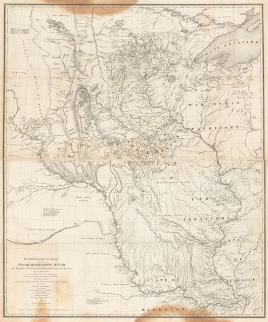
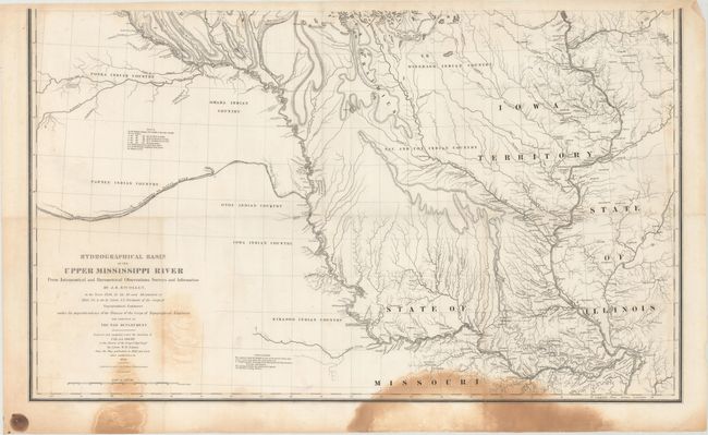
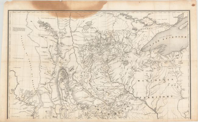
This extremely important map is the first accurate map of the interior region stretching from St. Louis north to the international boundary. The map was compiled by Lt. W. H. Emory (under the direction of Col. J. J. Albert) from the surveys of J. N. Nicollet, who was assisted by Lt. J. C. Fremont; thus, bringing together some of the most important names in the history of American mapping in the 19th century. Nicollet, already a noted French scientist and topographer, was chosen to lead this expedition during 1838 to 1840. The map reflects, for the first time, the use of the barometer to obtain elevations and the use of place names on maps based on a systematic analysis of Indian and French names. It is the first truly scientific topographical survey of the interior of North America. Contemporary cartographer, Lt. G. K. Warren, called it "one of the greatest contributions ever made to American geography." Lithographed by C. B. Graham and printed on two separate sheets.
References: Claussen & Friis #390; Schwartz and Ehrenberg, p. 267-268, plt. 165.
Condition: B
Issued folding with a few mis-folds and dark stains at the very top and bottom of the map. Please note that the first image is a composite image - the map is on two separate sheets.