Subject: Southeast United States, Bahamas
Period: 1865 (dated)
Publication:
Color: Black & White
Size:
35 x 51.5 inches
88.9 x 130.8 cm
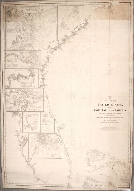
This large and richly detailed blue-backed chart by Charles Copley spans from Cape Florida to Cape Fear. It also extends to the Bahamas, including an in-depth look at the Great Bahama Bank. The chart is filled with navigational information such as soundings, anchorages, bottom types, hazards, and more. Lighthouses are indicated by red and yellow dots. The Gulf Stream is delineated. Along the left side of the chart, eight insets zoom in on major harbors, showing Charleston, Cape Roman Shoals, the Savannah River, St. John's River, Fernandina Harbor, Cape Canaveral, Turtle Harbor, and Cedar Cays. Distributed by the Hydrographic Office. Engraved by C.J. and F.S. Copley.
References:
Condition: B
There is toning in the top corners of the chart, light soiling that is more concentrated in the bottom right corner, and several short creases along the edges of the sheet. Two tears have been professionally repaired: a 5" tear at bottom and a 22" tear at top. Small portions of the neatline have chipped away at top and bottom right, with the neatline and part of the border seamlessly replaced in facsimile.