Subject: Colonial Mid-Atlantic United States
Period: 1778 (dated)
Publication:
Color: Hand Color
Size:
22 x 27.9 inches
55.9 x 70.9 cm
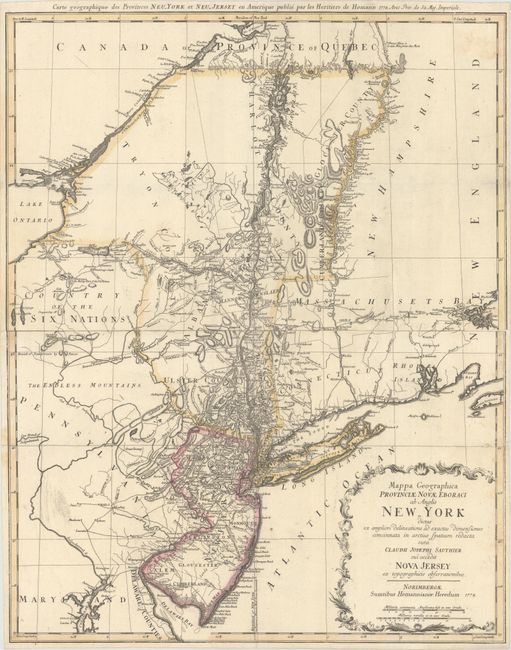
Handsome Revolutionary War period map of the region between Delaware Bay and Boston Harbor, north to include Montreal and west to the Finger Lakes district in New York. Based on the survey of the region by Claude Sauthier compiled between 1771 and 1774, the map provides excellent information including topographical detail, towns, forts, churches, roads, ferries, mills, and taverns. It shows Dartmouth College and the settlements along the northern part of the Connecticut River. The disputed lines of partition between New York and New Jersey are shown, as are boundaries of Pennsylvania with the Six Nations and other early boundaries. Two-sheets joined as issued.
References: McCorkle #778.19; Sellers & Van Ee #1049.
Condition: B+
Issued folding on watermarked paper with a few minor fold separations that have been closed on verso with archival materials. A short edge tear at right just enters the border.