Subject: Tonga Islands
Period: 1785 (circa)
Publication:
Color: Black & White
Captain James Cook (1728-1779) is best known for his three voyages to the Pacific (1768-71; 1772-75; and 1776-79). His discoveries radically changed the western understanding of the world in the late 18th century. He was the first to circumnavigate and chart New Zealand and provided the earliest European accounts of exploration along the eastern coast of Australia and the Hawaiian Islands. On February 14th, 1779, he was killed on Hawaii after attempting to kidnap the chief of the island.
Many contemporary accounts of Cook’s voyages, including charts and engravings, appeared in the late 18th century. The first official account of Cook’s first voyage was published in 1773 by John Hawkesworth in Volumes II and III of An Account of the Voyages Undertaken by the Order of His Present Majesty for Making Discoveries in the Southern Hemisphere... William Strahan and Thomas Cadell published the first official accounts of the second and third voyages in 1777 and 1784. Accounts of his exploration were subsequently translated into French, German, and Dutch.
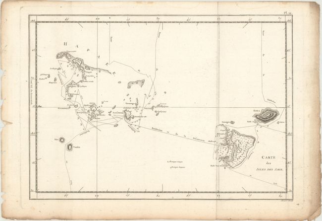
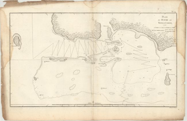
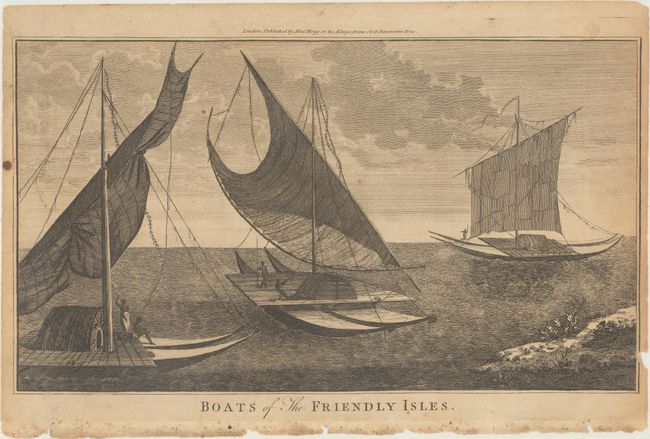
This interesting lot features three maps and a view from the Kingdom of Tonga. Cook named this group the Friendly Islands due to the generous reception he and his crew received when they first arrived there during their second journey. The first chart shows the Tongatapu and Ha'apai groups with the track of Cook's ship, the Resolution. The second zooms in on a segment of Tongapatu's northern coast. The third engraving depicts the Tongans' interesting catamaran type boats.
A. Carte des Isles des Amis, by Cook/Benard, from Troisieme Voyage De Cook, ou Voyage a l'Ocean Pacifique..., circa 1785 (13.5 x 9.5"). Condition: Issued folding on paper with a "Tamizier Auvergne Fin de 1783" watermark and marginal soiling. (A)
B. Plan du Havre de Tongataboo, 1777, by Cook/Benard, from Troisieme Voyage De Cook, ou Voyage a l'Ocean Pacifique..., circa 1785 (15.6 x 8.8"). Condition: Issued folding on paper with a bunch of grapes watermark, damp stains that enter the image at left and right, an extraneous crease along the centerfold, and heavy soiling along the sheet's edges. (B+)
C. Boats of the Friendly Isles, by Cook/Hogg, from A New, Authentic, and Complete Collection of Voyages Round the World..., circa 1784 (13.9 x 7.9"). Condition: On a lightly toned sheet with a few small spots in the image and some small chips and tears along the sheet's edges, including a couple that just enter the neatline at right. (B+)
References:
Condition:
See description above.