Subject: Pacific Ocean
Period: 1650 (published)
Publication: Novus Atlas
Color: Hand Color
Size:
21.6 x 17.4 inches
54.9 x 44.2 cm
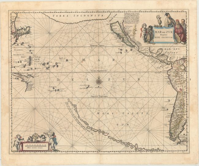
This significant map covers the whole Pacific Ocean along with the western coastlines of the Americas, Japan, and a bit of New Guinea and Cape York, Australia, showing the recent Dutch discoveries there. The top of the chart is dominated by a large landmass labeled Terra Incognita. A large Island of California appears, based on the Briggs type, most probably using Abraham Goos' map as a model. A curious chain of islands thread their way across the South Pacific with a legend that identifies these islands as being discovered by Hernando Galego in 1576. The chart is centered on a compass rose with rhumb lines and is ornamented with a great title cartouche with Asian figures and the distance scale with putti using navigational instruments. This is the first state with German text on verso.
References: Burden #292; McLaughlin #11; Tooley (Amer) p. 114, #10; Van der Krogt (Vol. I) #0600:1; Wagner (NW) #359.
Condition: B+
Contemporary color with light, scattered foxing and several centerfold separations that have been archivally repaired.