Catalog Archive
Auction 170, Lot 672

"Carte de la Guinee Contenant les Isles du Cap Verd, le Senegal, la Cote de Guinee Proprement Dite, les Royaumes de Loango, Congo, Angola et Benguela...", Santini/Remondini

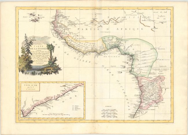
Subject: Western Africa

Period: 1779 (dated)

Publication: Atlas Universel...

Color: Hand Color

Size:
24.1 x 17.7 inches
61.2 x 45 cm
Download High Resolution Image
(or just click on image to launch the Zoom viewer)

This elegant map of western Africa is based on a map by Bonne. It provides a detailed view of the coastal regions from Cote d'Ivoire to Angola. Political divisions, towns and cities, rivers, mountains, deserts, and more are identified. The interior of the continent is still largely unexplored. Cape Verde appears off the coast. An inset at bottom left focuses on the Gold Coast, with a key to identify the region's colonizers. The decorative title cartouche features a predatory cat and a crocodile.

References:

Condition: B+

A crisp impression on a bright sheet with an "Imperial VO" watermark. There is light toning along the centerfold, some offsetting at right, and a small abrasion along the centerfold near the bottom or the image.

Estimate: $190 - $220

Sold for: $140

Closed on 11/14/2018

Archived