Subject: China
Period: 1860 (circa)
Publication: The Philips New General Atlas
Color: Hand Color
Size:
20.3 x 23.1 inches
51.6 x 58.7 cm
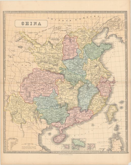
This attractive map of China is delineated by province and extends to include portions of Mongolia and Tibet. Depicts port cities, towns, rivers, lakes and topography. The Great Wall of China is shown in the north with a note stating "A Barrier of Wooden Pikes Dividing the Province of Quantong or Leatong from Tartary." Includes small insets of Hong Kong, Xiamen, and Zhoushan Island. Decorated by a keyboard-style border. Published in Liverpool & London (Philip moved his business to 32 Fleet Street, London in 1856).
References:
Condition: A
Bright original color with a few tiny spots in the image, light toning along the edges of the sheet, and a small chip at bottom right, well away from the image.