Subject: Northern Asia
Period: 1666 (circa)
Publication: Klaer Lichtende Noort-Ster Ofte Zee Atlas…
Color: Hand Color
Size:
21.9 x 17.2 inches
55.6 x 43.7 cm
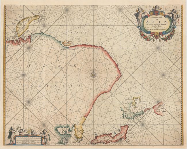
This attractive sea chart depicts the eastern coast of Asia including Russia, China, Korea and Japan. Much of this region had yet to be explored, leading to the inclusion of a speculative coastline from Korea to Nova Zemla. Japan, t'Land van Eso, and Compagnies Land reflect the discoveries of Maarten Gerritsz de Vries in 1643. Decorated by two cartouches, both featuring putti.
Johannes van Loon first published his Zee Atlas in 1661, and then sold the plates to Janssonius van Waesberge, who published a second edition of the Zee Atlas in 1669. Some of the plates in the second edition bear Waesberge's imprint, as evidenced in this example. Van Loon's maps are much less common than those of his peers, including Goos, Doncker, and Keulen.
References: Shirley (BL Atlases) M.LOON-1b.
Condition: B+
A dark impression with light printer's ink residue and a small, professionally repaired hole at bottom center. This example has been professionally remargined, with a minor amount of the neatline and top corners replaced in facsimile.