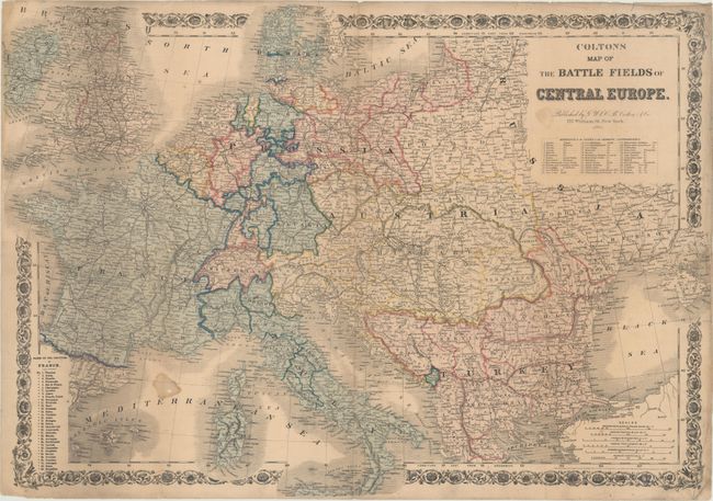
Subject: Central Europe
Period: 1866 (dated)
Publication:
Color: Hand Color
Size:
29.9 x 20.9 inches
75.9 x 53.1 cm
This large, separately issued map depicts the theater of war during the short-lived Austro-Prussian War of 1866. It covers the region from the British Isles and France east to Russia and the Black Sea. A key at right lists 39 German states, whose allegiance shifted toward the Prussians after they won the 42 day battle under the leadership of Otto von Bismarck. There are six distance scales presented at bottom right, and the map is surrounded by a decorative, floral border. No auction or dealer listings in the last 30 years and OCLC lists only two copies.
References:
Condition: B
Original color on a sheet that has been folded into 8 sections by a previous owner. There is a 6" edge tear at right and a number of fold separations that have all been closed on verso with archival tape with minor loss along at the fold intersections. Overall light toning and two small stains.