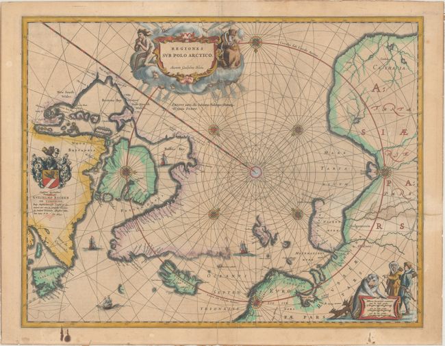
Subject: North Pole
Period: 1642 (circa)
Publication: Toonneel des Aerdrycks...
Color: Hand Color
Size:
20.9 x 16.2 inches
53.1 x 41.1 cm
This important prototype map of the Arctic incorporates new information from the explorations of Capt. Thomas James with the bay named for him labeled here James his Bay. The Arctic coast of Russia provides information from Willem Barentsz' voyage, and Spitsbergen is shown according the Danish expedition of James Hall. Rhumb lines radiate from the North Pole, and a large title cartouche, with two figures and numerous wind heads, conveniently hides the northwest coast of America. The map is further decorated with several compass roses, ships, and an additional cartouche that features men in parkas, a polar bear, and foxes. Dedication to Guilielmo Backer de Corneliis (with Johanes Blaeu's imprint), indicates this issue is from the second state of the plate. Dutch text on verso, published between 1642-61.
References: Burden #252; Goss (Blaeu) #2; Van der Krogt (Vol. II) #0020:2.2.
Condition: B+
On watermarked paper with a 2.5" edge tear at right and short centerfold separations at top and bottom that have all been archivally repaired on verso. There is light surface soiling and the dedication cartouche has been underlined in manuscript.