Subject: Strasbourg, France
Period: 1770 (circa)
Publication:
Color: Hand Color
Size:
13.3 x 14.8 inches
33.8 x 37.6 cm
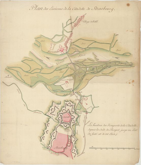
This elegant manuscript map depicts Strasbourg in Alsace, on the border of Germany and France. After the signing of the Treaties of Nijmegen in 1679, France had control over all of Alsace, with the notable exception of Strasbourg, which remained an independent city. Because of its location on the Rhine, Louis XIV saw the city as a strategic asset. He sent in French forces to capture the city on September 30, 1681. Sebastien Le Prestre de Vauban, the revered French military engineer, immediately set to work building a large fort on the Strasbourg side of the river and a smaller fort on the other side of the Rhine in the village of Kehl. The project took four years. Years after their completion, Vauban described his work at Strasbourg as "the most considerable fortifications in Europe that no power can take. The excellence of the defenses make them virtually invincible." The fortifications held up for nearly two centuries, before both were heavily bombarded in 1870 during the Franco-Prussian War. This plan shows in nice detail both fortifications, the city of Strasbourg, the village of Kehl, the Rhine, and the surrounding countryside.
References:
Condition: B+
Issued folding, now flat, on a watermarked sheet with some small spots in unengraved areas at right and light toning along the sheet's right edge.