Subject: Southern France
Period: 1594 (dated)
Publication: Theatrum Orbis Terrarum
Color: Hand Color
Size:
20 x 13.6 inches
50.8 x 34.5 cm
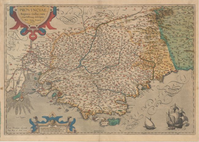
This superb map of the region of Provence along the Mediterranean extends from the Camargue region in the west to past Nice in the east, and as far north as Gap. The Rhone River delta is well depicted, and the Durance River is shown winding through the region. The map is filled with tiny villages, and larger cities are depicted as castles, including Marseille, Nice, Aix, Avignon, and Arles. The map is handsomely adorned with a pair of sailing ships and two strapwork cartouches. The map is based on Jean Pierre de Bompar's single-sheet map of Provence published in 1591. Dated 1594 and published in 1595 with Latin text on verso. According to Van den Broecke, this is the second edition. It was preceded only by an earlier 1595 map with a blank verso.
References: Van den Broecke #47.
Condition: B+
On watermarked paper with contemporary color and two small abrasions adjacent to the centerfold at bottom. A small tear in the top blank margin has been repaired on verso with archival material.