Subject: Ireland
Period: 1610 (circa)
Publication: Camden's Britain
Color: Hand Color
Size:
13.2 x 10.5 inches
33.5 x 26.7 cm
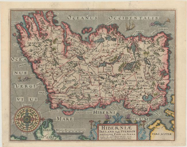
A decorative seventeenth century map that depicts the Emerald Isle, oriented with the north on the right. The map is based closely on Mercator's map of 1595, and is divided into counties with fair detail of mountains, forests, rivers, lakes and towns. It is richly ornamented with a strapwork title cartouche, ships and sea monsters in a stippled sea and an elaborate compass rose. The map was first published in the Latin text edition of Camden's Britannia in 1607 with Latin text on verso, and was reprinted for English text editions in 1610 and 1637 with no text on verso, as seen with this example.
References: Shirley (BL Atlases) T.CAMD-1c; Law, pp. 36-37.
Condition: B+
A fine impression on watermarked paper with an archivally repaired tear that enters 1/2" into map at top with a minute loss of image. A clean and bright example.