Subject: Iura, Scotland
Period: 1654 (published)
Publication: Le Theatre du Monde ou Nouvel Atlas...
Color: Hand Color
Size:
20.8 x 16.1 inches
52.8 x 40.9 cm
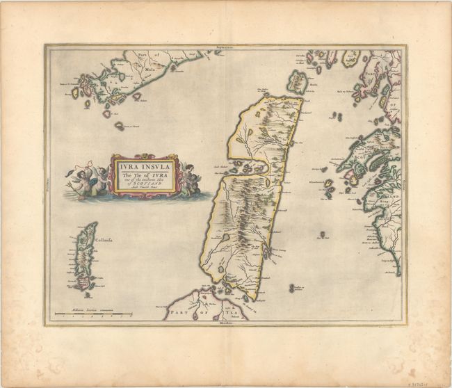
This handsome map centers on the island of Jura in the Inner Hebrides. Place names, lochs, forests, and rivers are depicted. The main topographical feature of the map is the Paps of Jura, the quartzite mountains in the middle of the island. Parts of Knapdale, the Isle of Mull, and Islay are located as well as Colonsay and various smaller islands. French text on verso.
Publication of Bleau’s atlas of Scotland (Atlas Novus, Volume V) in 1654 was a landmark publication in cartographic history. Most of the maps were based on the surveys of Timothy Pont, which had been done half a century earlier. The publication took over seven decades to bring to publication; it was delayed by wars, copyright restrictions, and only intermittent official support. The maps are scarce today due to the relatively short publication history of the atlas.
References: Van der Krogt (Vol. II) #5883:2.
Condition: A
A crisp impression with contemporary color on watermarked paper. There is light printer's ink residue and dampstains confined to the lower blank margins.