Subject: Outer Hebrides, Scotland
Period: 1654 (published)
Publication: Le Theatre du Monde ou Nouvel Atlas...
Color: Hand Color
Size:
22.9 x 17.8 inches
58.2 x 45.2 cm
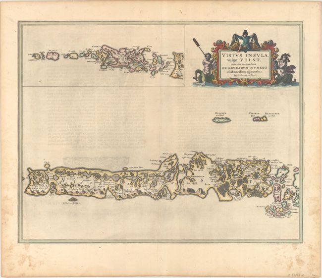
This stunning map of the Uists and Barra in the Outer Hebrides provides a very early view of the region. The main map details from Berneray to South Uist, and the inset continues the island chain to Barra Head. French text on verso.
Publication of Bleau’s atlas of Scotland (Atlas Novus, Volume V) in 1654 was a landmark publication in cartographic history. Most of the maps were based on the surveys of Timothy Pont, which had been done half a century earlier. The publication took over seven decades to bring to publication; it was delayed by wars, copyright restrictions, and only intermittent official support. The maps are scarce today due to the relatively short publication history of the atlas.
References: Van der Krogt (Vol. II) #5872:2.
Condition: A
A fine impression with light dampstains that are almost entirely confined to the blank margins.