Catalog Archive
Auction 170, Lot 466

"Scotiae Provinciae Mediterraneae Inter taum Flumen et Vararis Aestuarium... / A Description of the Inland Provinces of Scotland Lying Between Tay River and Murra Fyrth...", Blaeu, Johannes
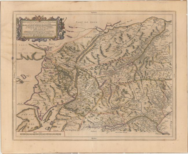
Subject: Scotland

Period: 1654 (published)

Publication: Le Theatre du Monde ou Nouvel Atlas

Color: Hand Color

Size:
20.9 x 16.5 inches
53.1 x 41.9 cm
Download High Resolution Image
(or just click on image to launch the Zoom viewer)

A beautiful and uncommon map based on the manuscript drafts of Timothy Pont and the revisions of Robert Gordon. The area shown is between the Tay River and Murray Firth, including Loch Ness, part of the Isle of Skye and Mull Island. Timothy Pont surveyed Scotland in the 1580s and 1590s, but his maps were not published in his lifetime. Robert Gordon took Pont's maps, clarified them, and passed them onto Joan Blaeu, who published them in his 1654 Nouvel Atlas. These maps formed the basis for the cartography of Scotland for the next one hundred years. French text on verso.

References: Van der Krogt (Vol. II) #5840:2.

Condition: B+

Contemporary color with scattered foxing, light offsetting, and minor staining at left.

Estimate: $325 - $400

Sold for: $170

Closed on 11/14/2018

Archived