Subject: Radnorshire, Wales
Period: 1610 (dated)
Publication: The Theatre of the Empire of Great Britaine...
Color: Black & White
Size:
20.1 x 15.1 inches
51.1 x 38.4 cm
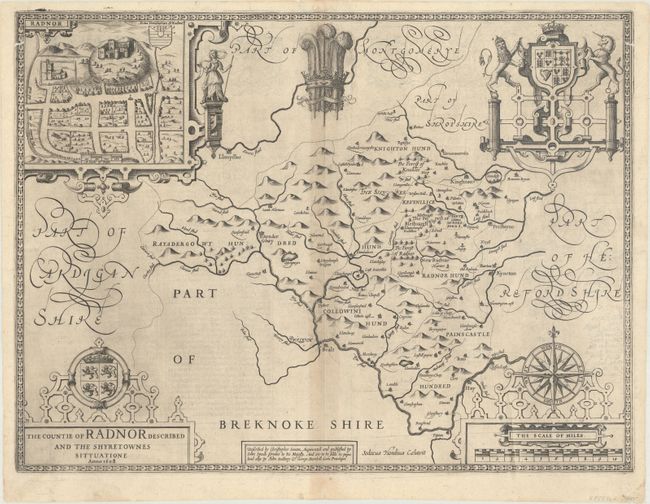
This beautiful map of Radnorshire was engraved by Jodocus Hondius. It includes four decorative cartouches, a view of the castle at Radnor, scale of miles, coat of arms, title, Prince of Wales feathers, and fancy script lettering. Speed rarely credited his sources, but in this case he credits his great predecessor, Christopher Saxon, with the basic information on this map. Saxon published his atlas in 1579 and included regional maps of Wales. Speed wanted to make his atlas distinctive, so he separated his maps into individual counties. There is modest detail throughout the map. English text on verso with the imprint of John Sudbury and George Humble.
References: Shirley (BL Atlases) T.SPE-1b.
Condition: B+
A crisp impression on a watermarked sheet with light toning and offsetting along the centerfold, a pair of short worm tracks on the border at top left and top right, and light printer's ink residue.