Subject: Eastern England
Period: 1878 (dated)
Publication:
Color: Printed Color
Size:
16.6 x 13 inches
42.2 x 33 cm
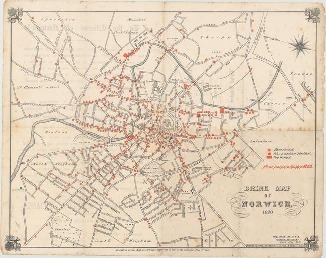
This rare map of Norwich was published by the United Kingdom Alliance, an English temperance organization, in order to shed light on what they believed to be a serious drinking problem in the city. The map shows the detailed street layout of the town with the location of beer houses, full licensed houses and breweries depicted in red overprinting. The map notes that there are 655 Licensed Houses, meaning it would take nearly two years to visit each one. The population of Norwich in 1878 was approximately 78,500, which breaks down to about 120 souls per drinking establishment (hence the need for this map as seen by the U.K.A!). The verso contains a statement by the alliance as to the purpose of the map. A fascinating piece.
References:
Condition: B
Issued folding with scattered foxing and several short fold separations that have been closed on verso with archival tape. There is light show-through of text from verso.