Subject: North Atlantic
Period: 1660 (published)
Publication: De Zee-Atlas ofte Water-Waereld
Color: Hand Color
Size:
20.8 x 16.8 inches
52.8 x 42.7 cm
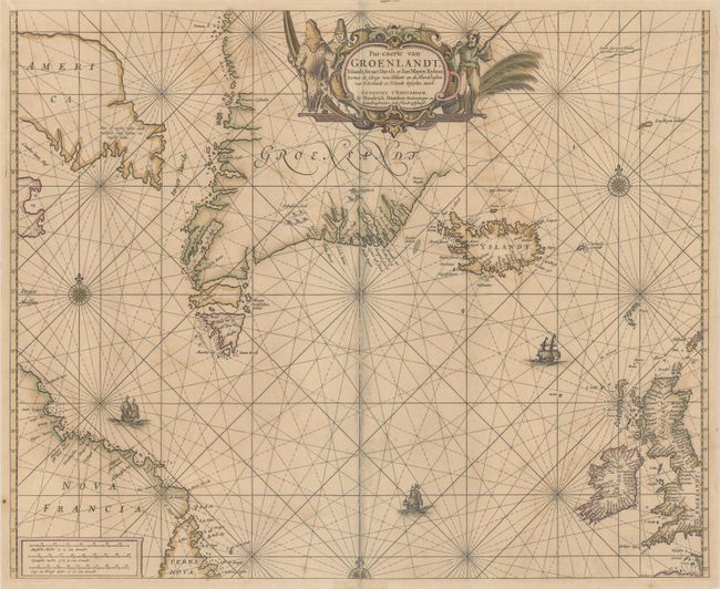
A boldly engraved chart of the northern Atlantic extending from Newfoundland and the United Kingdom in the south, to Baffin Island, Greenland, Iceland and Jan Mayan Island in the north. There are place names scattered along the coastlines, and inland detail is limited to a few mountains. In Baffin Island (here called America) there is a notation that translates as: "Here is fresh fish, dead whales, white foxes and fresh salmon." A partial outline continues to the northeast of Greenland. The decorative title cartouche is surrounded by native hunters. This is the second state with the addition of Straet Davids to the west of Greenland.
References: Burden #337; Phillips (Atlases) #468-6.
Condition: B
Contemporary color with light toning and offsetting, and a long centerfold separation that has been closed on verso with archival tissue.