Catalog Archive
Auction 170, Lot 426
"A Map of ye Port of Baldivia with the Fortifications and Islands &c... [on sheet with] The Bay of Guiaquil &c... [and] A Map of the Isle Chiloe. The Lake of Ancuna, with the Islands &c...", Moll, Herman
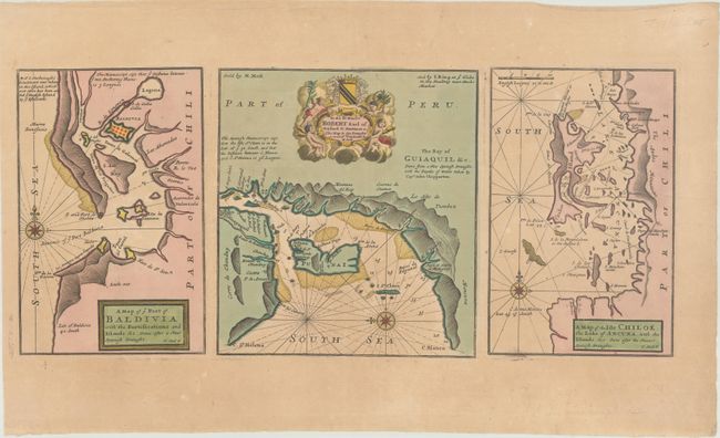
Subject: Chile & Ecuador
Period: 1720 (published)
Publication:
Color: Hand Color
Size:
19.6 x 8.6 inches
49.8 x 21.8 cm
Download High Resolution Image
(or just click on image to launch the Zoom viewer)
(or just click on image to launch the Zoom viewer)