Subject: Lesser Antilles
Period: 1758 (circa)
Publication: Prevost's Histoire Generale des Voyages
Color: Black & White
A nice collection of Bellin maps focused on the Lesser Antilles and issued in the 15th volume of Prevost's Histoire Generale des Voyages. The maps include:
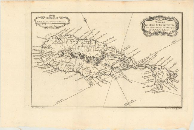
A. Carte de de l'Isle St. Christophe... (12.1 x 7.6"). This lovely map of St. Kitts is fully engraved with mountains, rivers, lakes, and towns. The island has twelve quarters and parishes. In the center of the island a note on the mountain Mont Misery locates Mines de Souffre. Grande Saline, Ville de la Basse Terre, forts, churches, and more are identified. Decorated with baroque-style title and scale of miles cartouches and a fleur-de-lys, all fully colored. Condition: A dark impression on a clean sheet. Issued folding. (A)
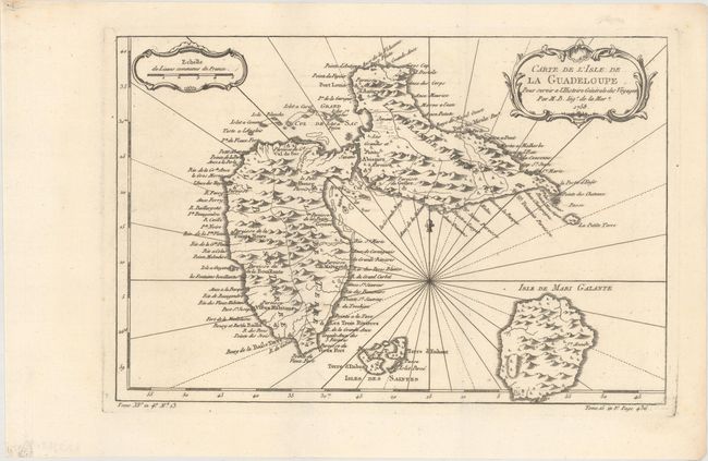
B. Carte de l'Isle de la Guadeloupe..., dated 1758 (11.9 x 7.9"). A very handsome map adorned with rhumb lines, fleur-de-lys, and two decorative rococo-style cartouches. Filled with good detail and place names throughout. Also includes the islands of Marie-Galante and the Iles des Saintes. Condition: A dark impression on a clean sheet. Issued folding. (A)
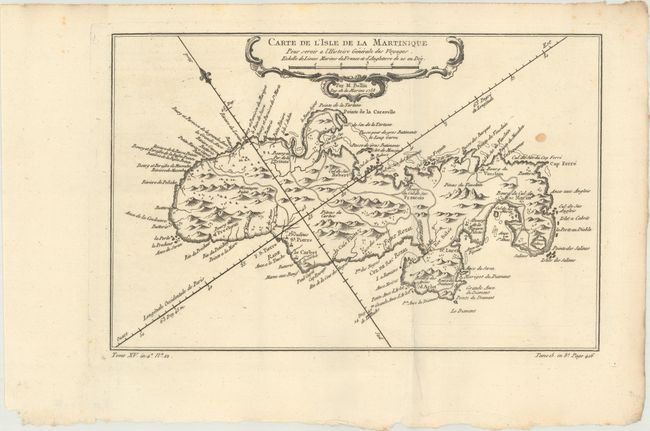
C. Carte de l'Isle de la Martinique..., dated 1758 (11.9 x 7.8"). Delicately detailed map of the island showing mountains, roads, towns, forts, anchorages, and dozens of place names. Exhibiting fine coastal detail, the chart locates Sac Marin, Bourg de la Rivieree Pilote, Se. Luce, Fort Royal, Fort S. Pierre, the Pitons du Vauclain, roads, watershed, graphic topography, shoals, and anchorages. Condition: A dark impression on a clean sheet with one small spot. Issued folding. (B+)
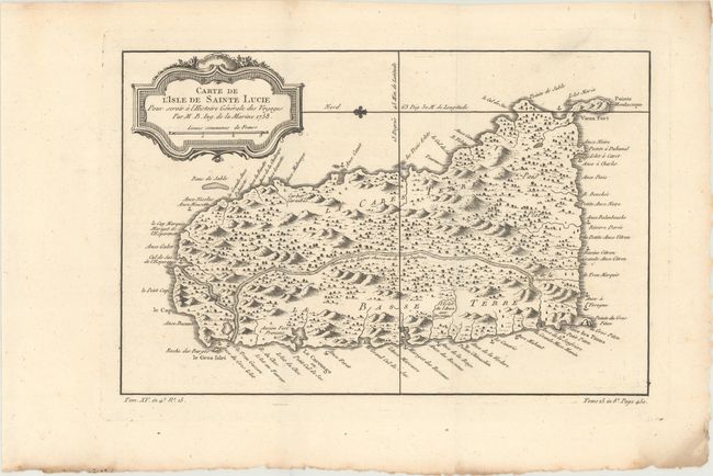
D. Carte de l'Isle de Sainte Lucie..., dated 1758 (11.7 x 7.6"). This map of St. Lucia divides the island into the region controlled by the native Caribs and the colonial sugar plantations. It includes a decorative title cartouche and is fully engraved with mountains, forests, rivers, roads, towns, and anchorages. A fleur-de-lis orients the map with north to the left. Condition: A dark impression on a clean sheet. Issued folding. (A)
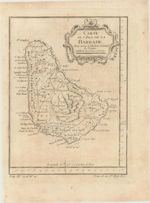
E. Carte de l'Isle de la Barbade... (5.8 x 7.8"). This small map of Barbados divides the island into eleven parishes with a well developed network of roads throughout. Condition: Light toning. (B+)
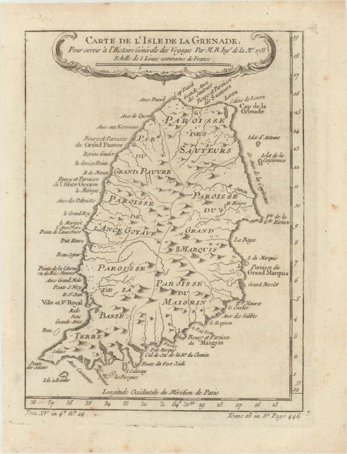
F. Carte de l'Isle de la Grenade... (6.1 x 8.3"). Very well-described chart of the island showing administrative subdivisions (Paroisee du Grand Marquis, etc.), villages, churches, watershed, and some relief. Many features are named along the coastline. Condition: Minor foxing. (B+)
References:
Condition:
See description above.