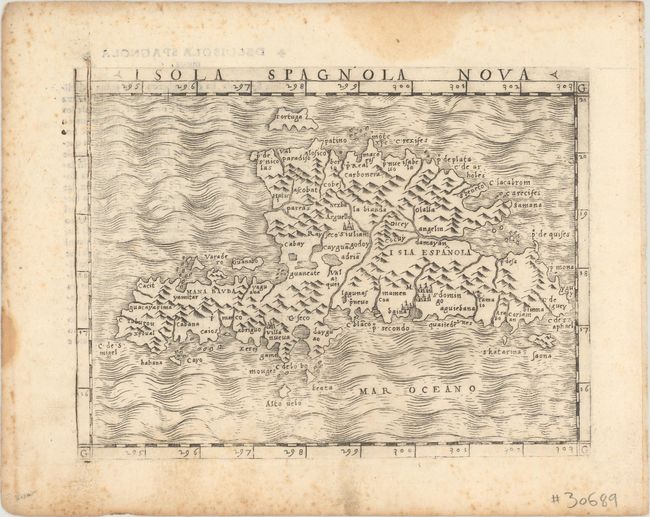
Subject: Hispaniola
Period: 1548 (published)
Publication: La Geografia di Claudio Ptolemeo Alessandrino
Color: Black & White
Size:
6.7 x 4.9 inches
17 x 12.4 cm
This fine early copperplate engraving of Hispaniola is one of the earliest maps of the island, and is rendered in the characteristic Italian style. The topographical features such as mountain ranges and river systems are boldly drawn and only a few cities are located. Italian text on verso describes the island.
Gastaldi's edition of Ptolemy's Geography was the first to include regional maps of the American continent. With maps engraved on copper, Gastaldi's work was conceived as the first "pocket" or miniature atlas. His monumental work was the most comprehensive atlas produced between Waldseemuller's Geographiae of 1513 and Ortelius' Theatrum of 1570.
References: Mickwitz & Miekkavaara #214-58.
Condition: B+
There is light foxing that is mostly confined to the blank margins, and several stains along the edges of the sheet.