Subject: World
Period: 1748 (dated)
Publication:
Color: Hand Color
Size:
27.8 x 19.9 inches
70.6 x 50.5 cm
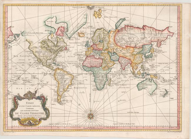
This very large and attractive world chart is drawn on Mercator's projection. North America is shown with a prominent River of the West connecting through a series of rivers and lakes from Lake Superior to the Pacific - representing the elusive search for a Northwest Passage. The Russian discoveries in the North Pacific are shown with Alaska depicted as an island named I. Unamak. Australia is labeled Nouvelle Hollande with Terre de Diemen still linked to the mainland. New Zealand is fully formed showing both islands and there are numerous islands in the Pacific. The large, decorative title cartouche and two fine compass roses with rhumb lines make this a very attractive chart. Australia and New Zealand reflect the discoveries of Capt. Cook, but Tasmania is still attached to Australia, suggesting a publish date after 1770.
References:
Condition: B+
A crisp impression on a clean, bright sheet of watermarked paper. Issued folding and now flattened with a large chip (between northern Asia and the Solomon Islands) at far left that has been professionally and seamlessly reattached. There are a few additional minor repairs to separations along the folds.