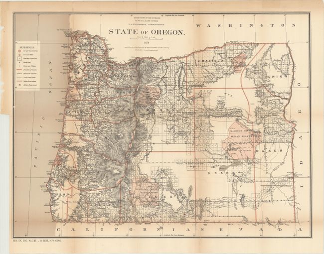
Subject: Oregon
Period: 1879 (dated)
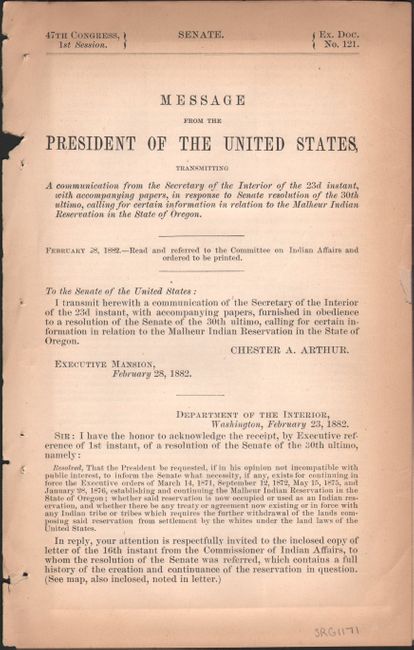
Publication: Sen. Ex. Doc. No. 121, 47th Congress, 1st Session
Color: Printed Color
Size:
22.3 x 16.8 inches
56.6 x 42.7 cm
This is the earliest GLO map of the state to use printed color. It was compiled from official records in the GLO and other sources by C. Roeser, Principal Draughtsman, under the direction of J.A. Williamson, Commissioner. The map features excellent detail from the Cascade Mountains west to the Pacific Ocean, with surveying efforts well under way in the central and eastern portions of the state. The legend identifies railroads, Indian Reservations, Military Reservations, towns and villages, and more. Includes 4 page Senate report related to the Malheur Indian Reservation.
References:
Condition: B
Issued folding with several fold separations and a 3.5" binding tear at left that have all been closed on verso with archival tape. There is light toning along the fold lines.