Subject: New York City, New York
Period: 1962 (circa)
Publication:
Color: Printed Color
Size:
41.9 x 33.1 inches
106.4 x 84.1 cm
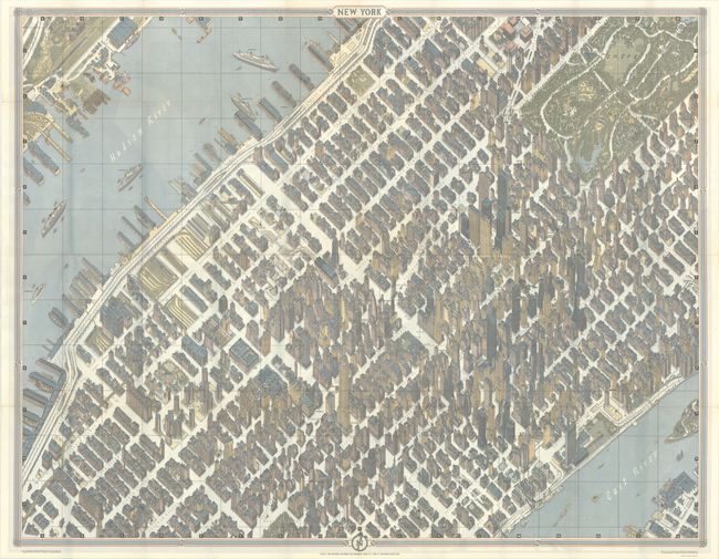
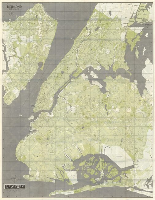
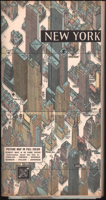
This large, stunning bird's-eye view was created by Hermann Bollmann in West Germany for Pictorial Maps, Inc. of New York. The map covers midtown Manhattan from 13th Street to Central Park, and shows individual buildings with an unusual and precise 3D-effect to convey relative size. Intended for the tourist, the map identifies many points of interest including the Empire State Building, Chrysler Building, Rockefeller Center, Gimbels, Macy's, Madison Square Garden, and many more. The verso contains a detailed map of the city's five boroughs. The map is housed in pictorial paper wrappers with a 45 page guide including portions in French, German, Italian, Spanish, and Japanese.
According to the inside panel of the paper wrapper, Bollmann took 67,000 photographs of the city (17,000 in the air) in order to create this hand-drawn map. It further states "to solve the problem of skyscrapers and concentration of building, Bollmann has used several unique devices which remain his secret." Beginning in 1948, Bollmann drew 39 maps of similar style of European cities to show the destructive impacts of World War II.
References: Augustyn & Cohen (Manhattan) pp. 152-53.
Condition: A
Issued folding on a clean, bright sheet with a few tiny splits at fold intersections. Paper wrappers and text have just a hint of pleasant toning.