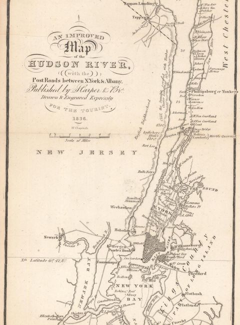
Subject: New York
Period: 1836 (dated)
Publication:
Color: Black & White
Size:
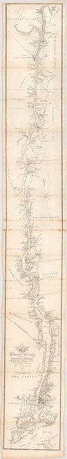
5.3 x 41.2 inches
13.5 x 104.6 cm
This remarkable, early strip map follows the course of the Hudson River from above Albany down to Manhattan and New York Bay. The primary emphasis is on the road network along the river's path, but the map also names individual property owners, churches, schools, taverns, and more. Engraved by William Chapin and published by Harper Brothers in New York. Originally issued on two joined sheets in The Tourist or Pocket Manual for Travellers on the Hudson River, and now housed in modern boards (5 x 7").
References: Phillips (Maps) p. 324; cf. Howes #V-28.
Condition: B+
There are a few spots of light scattered foxing and minor staining where the two sheets were glued together. Modern covers have minimal wear.