Subject: Minnesota
Period: 1879 (dated)
Publication:
Color: Printed Color
Size:
24.6 x 31 inches
62.5 x 78.7 cm
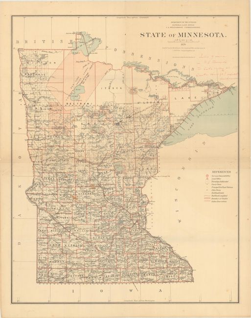
This large map of the state shows the extent of the surveying effort, with only the very northern counties yet to be surveyed. It depicts cities, towns, forts, rivers, lakes, and the early roads and railroads of the state. A large portion of the northern area is composed of the Red Lake Unceded Indian Lands established by the Treaty of 1863. The map shows the entire state on a scale of fifteen miles per inch and extends to the Pigeon River Indian Reservation on the shores of Lake Superior. This edition was made under the direction of J.A. Williamson, Commissioner and drawn by Charles Roeser, Principle Draughtsman.
References:
Condition: B
Issued folding with light toning, some manuscript ink notations in the image, and a few small stains. There are several separations along the folds and a small hole at the fold intersection at center.